
Classic Routes
North Trails
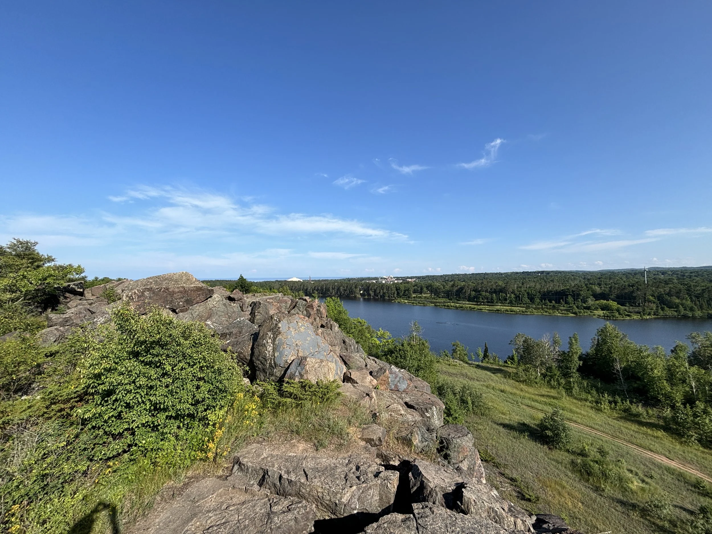
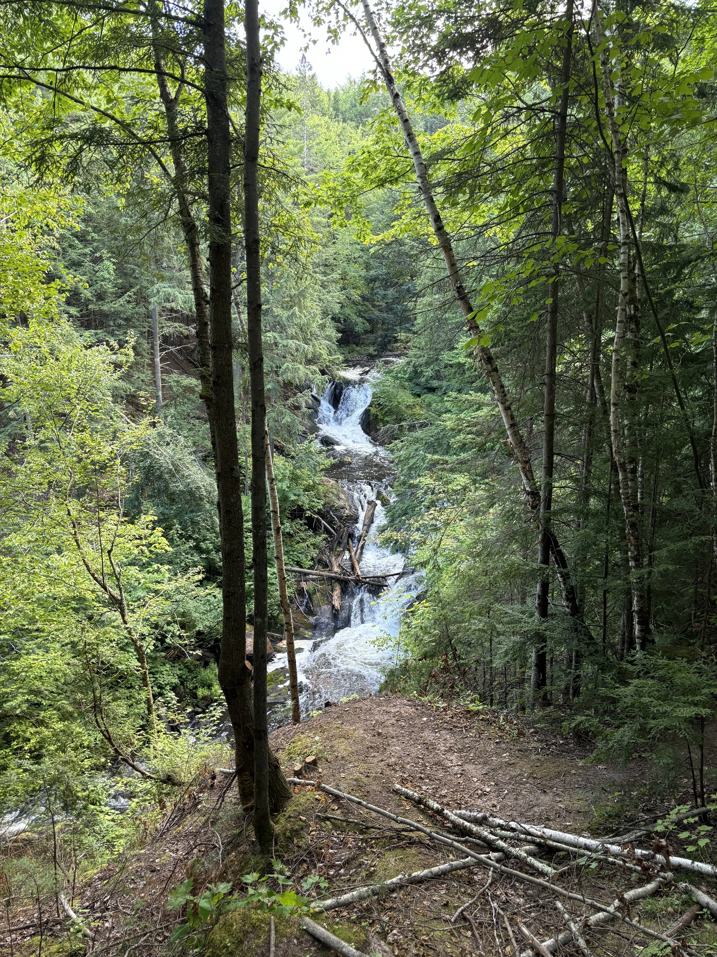
Dead River and Superior Dome. Photo by Tony Barnes.
Explore the heart of Marquette’s premier forest network. This trip takes you deep into the North Trails, a sprawling system of ridges, pines, and river bluffs. We’ll navigate the winding North Country Trail to reach the high-point overlooks that provide a bird's-eye view of the Dead River basin and the rugged interior of the Noquemanon trail corridor.
-
Expect rolling terrain, some sandy ascents, and winding paths with frequent elevation shifts. Plan for roots, rocks, and ruts.
-
A steady, athletic pace that covers significant ground while allowing for stops at the major vistas.
-
A curated loop designed to hit the most scenic ridges and river overlooks.
-
The Dead River overlooks, old-growth pine groves, and the granite outcroppings of north Marquette.
-
Includes expert navigation through a complex trail network.
Presque Isle Park +
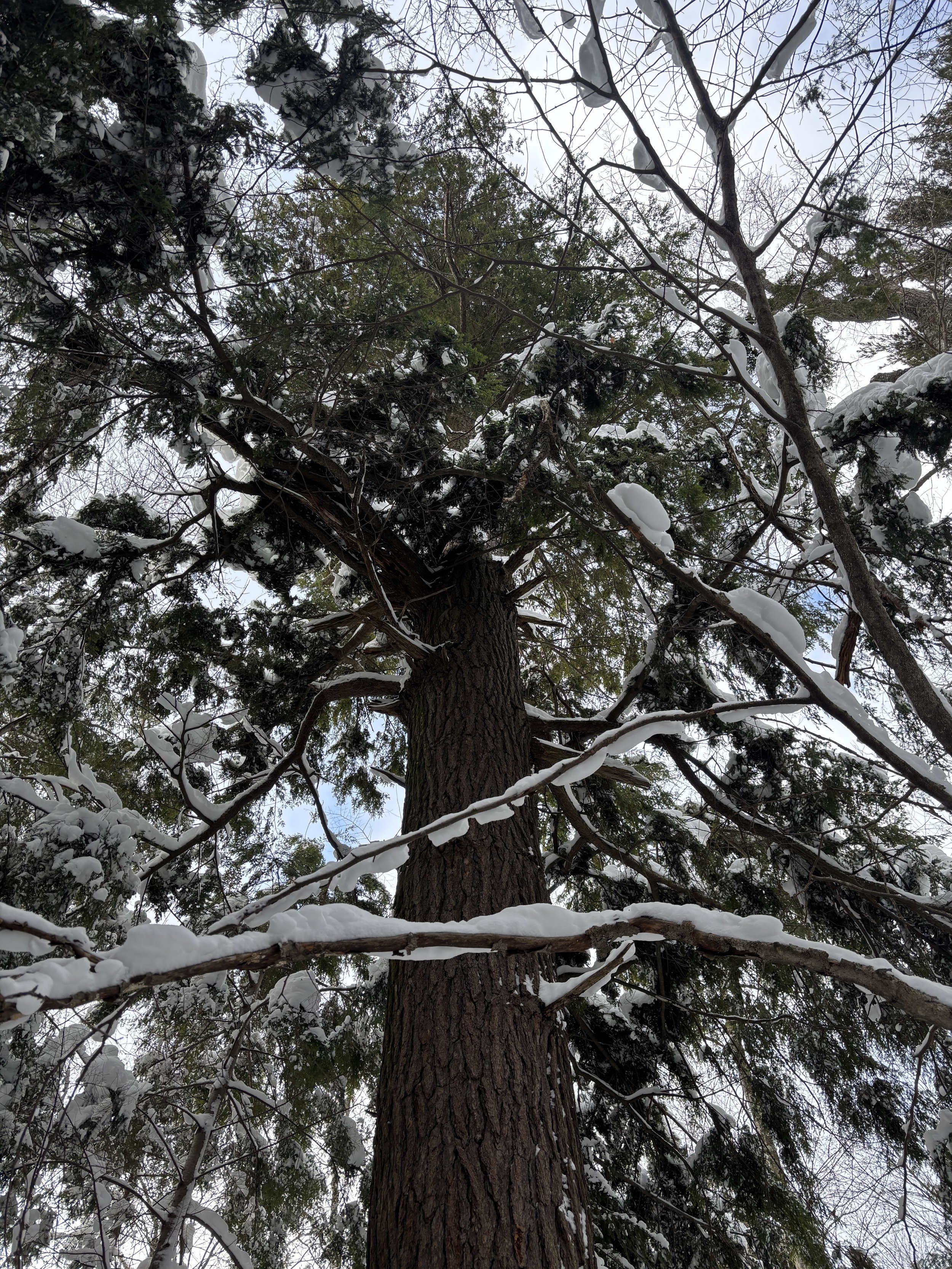
Big ol’ Presque Isle Hemlock. Photo by Tony Barnes.
We head into the heart of the Island. This route leaves the paved path to explore the interior forest trails and the hidden shoreline cliffs. You’ll get a mix of Lake Superior's majesty and the quiet, old-growth cathedral of the interior woods, seeing the Island from two completely different perspectives.
-
Includes some dirt trails with roots and minor elevation changes near the shoreline cliffs.
-
A steady pace with stops at three distinct shoreline ecosystems.
-
A comprehensive loop combining the perimeter and the interior forest.
-
The giant hemlocks, secluded coves, and best vantage point for the sunset.
-
Includes the transition from the park’s public roads to its interior and rugged, unmarked shoreline corridors.
Sugarloaf +
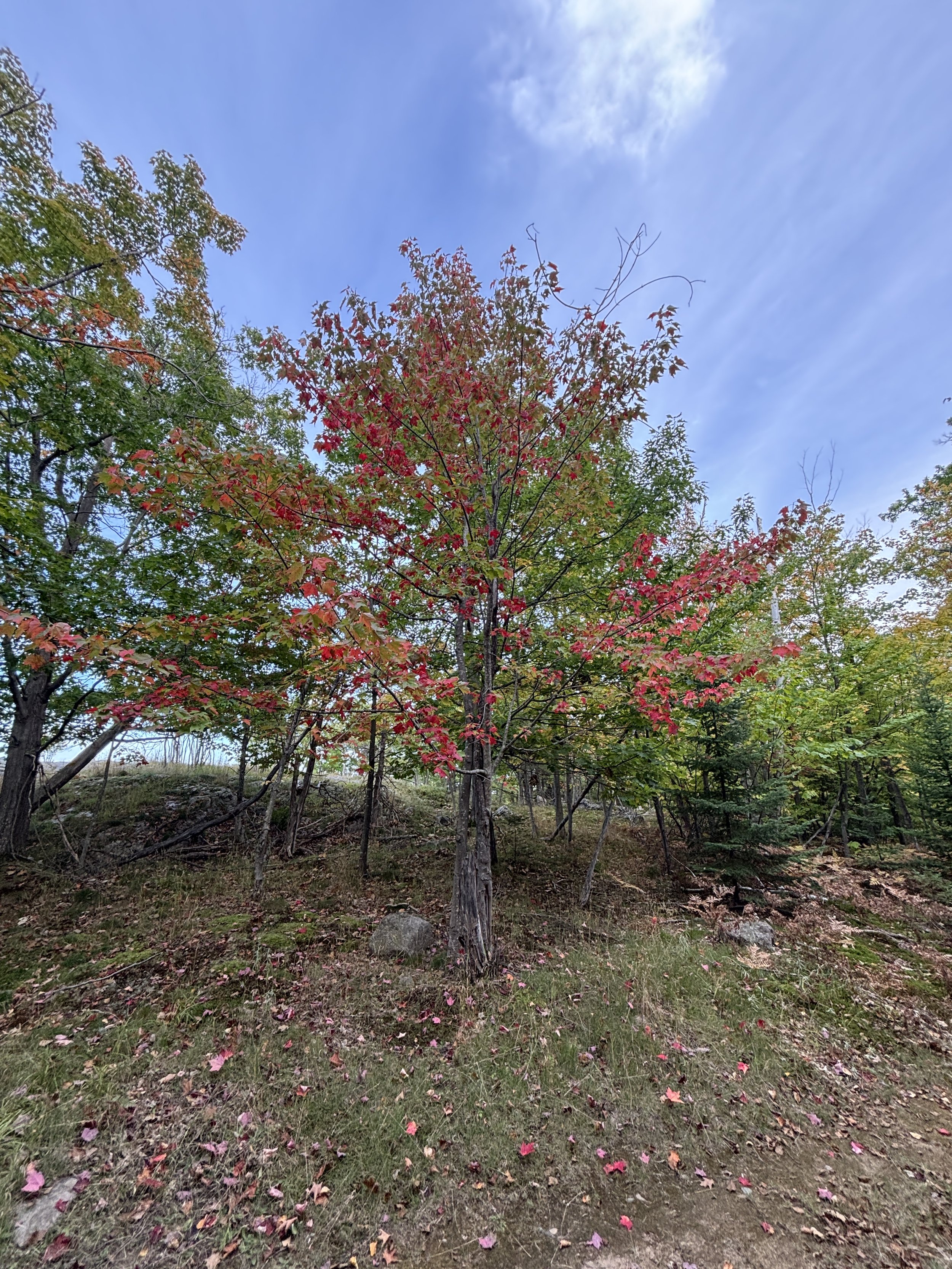
Sugarloaf west. Photo by Tony Pelletier.
For those who want to earn the view. We take the "Difficult" trail—a rugged, root-filled scramble that feels like a true wilderness hike. Along the way, we’ll identify local flora and discuss the ancient geology of the mountain before reaching the summit.
-
Involves steep rocky sections and uneven terrain.
-
Allows for a technical ascent and a longer summit break.
-
A more "off-the-beaten-path" approach using the forest terrain and rock outcrops as our guide.
-
Hidden rock outcroppings and private quiet moments at lesser-known lookouts.
-
Unlike the standard tourist paths, this route requires expert guidance to navigate steep rock faces and unmarked forest ridges safely.
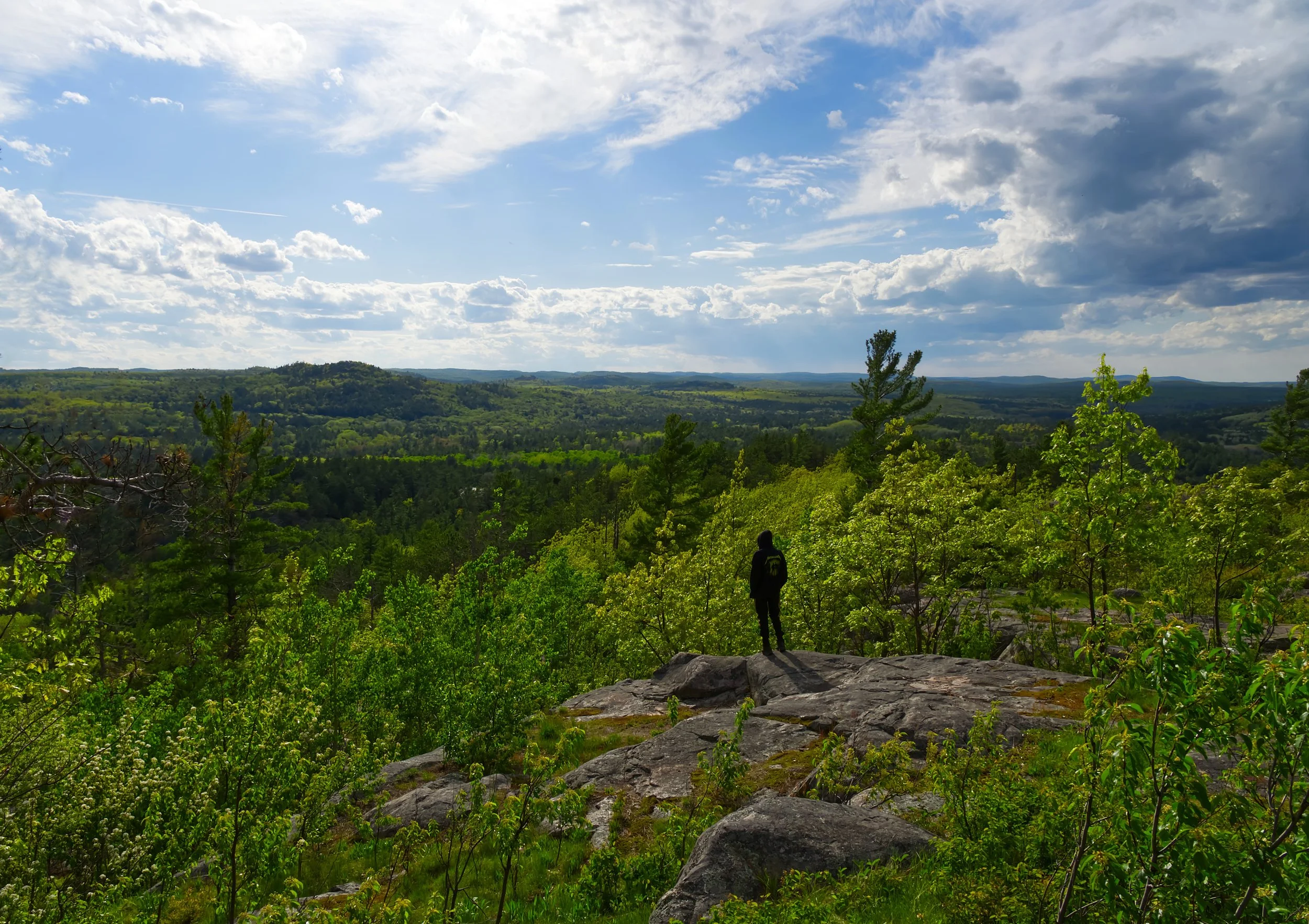
Mt. Marquette
Mount Marquette Fall Colors. Photo by Tony Barnes.
Rising 1,200 feet above sea level, Mt. Marquette offers the definitive panoramic view of the Marquette harbor, the ore docks, and the vast expanse of Lake Superior. This hike skips the dusty driving road in favor of the hiking trails. We’ll climb through dense hardwoods and across ancient tectonic lift-lines to reach the overlook with hidden granite perches that offer 270-degree views of the Iron Range and the city below.
-
A steady, sustained climb with some steep sections. We take frequent "breather" stops at scenic breakpoints to ensure the ascent is enjoyable, not exhausting.
-
This includes the forest ascent, significant time for summit photography/storytelling, and a relaxed descent.
-
A vertical-focused loop that emphasizes elevation gain and panoramic payoffs.
-
A bird's-eye view of the Lower Harbor and the Superior dome.
-
Includes expert pacing and navigation through the steep, unmarked forest spurs.
South Trails
Carp River Falls. Photo by Tony Barnes.
Experience the rugged soul of Marquette’s wilderness. This trip is a masterclass in Upper Peninsula landscapes, taking you across ancient granite ridges and through dense hemlock forests to the secluded Morgan Falls. We navigate the technical "Greywalls" terrain, which is some of the oldest exposed rock on earth, to reach dramatic overlooks of the Carp River Valley before descending to the cool, moss-covered sanctuary of the falls. This is the perfect route for those who want both the "big view" and the "hidden water" in a single journey.
-
Expect frequent elevation shifts, rocky staircases, and uneven granite surfaces that require steady footing.
-
A deliberate, active pace that allows for exploration at the falls and several panoramic photo stops on the ridges.
-
A technical loop that prioritizes scenic quality and geological landmarks over simple mileage.
-
Discover the hidden grotto of Morgan Falls and the 2.3-billion-year-old "Greywalls" granite ridges.
-
Includes expert navigation through a notoriously complex and technical trail system.