
Forests & Rivers
Chocolay River Bayou
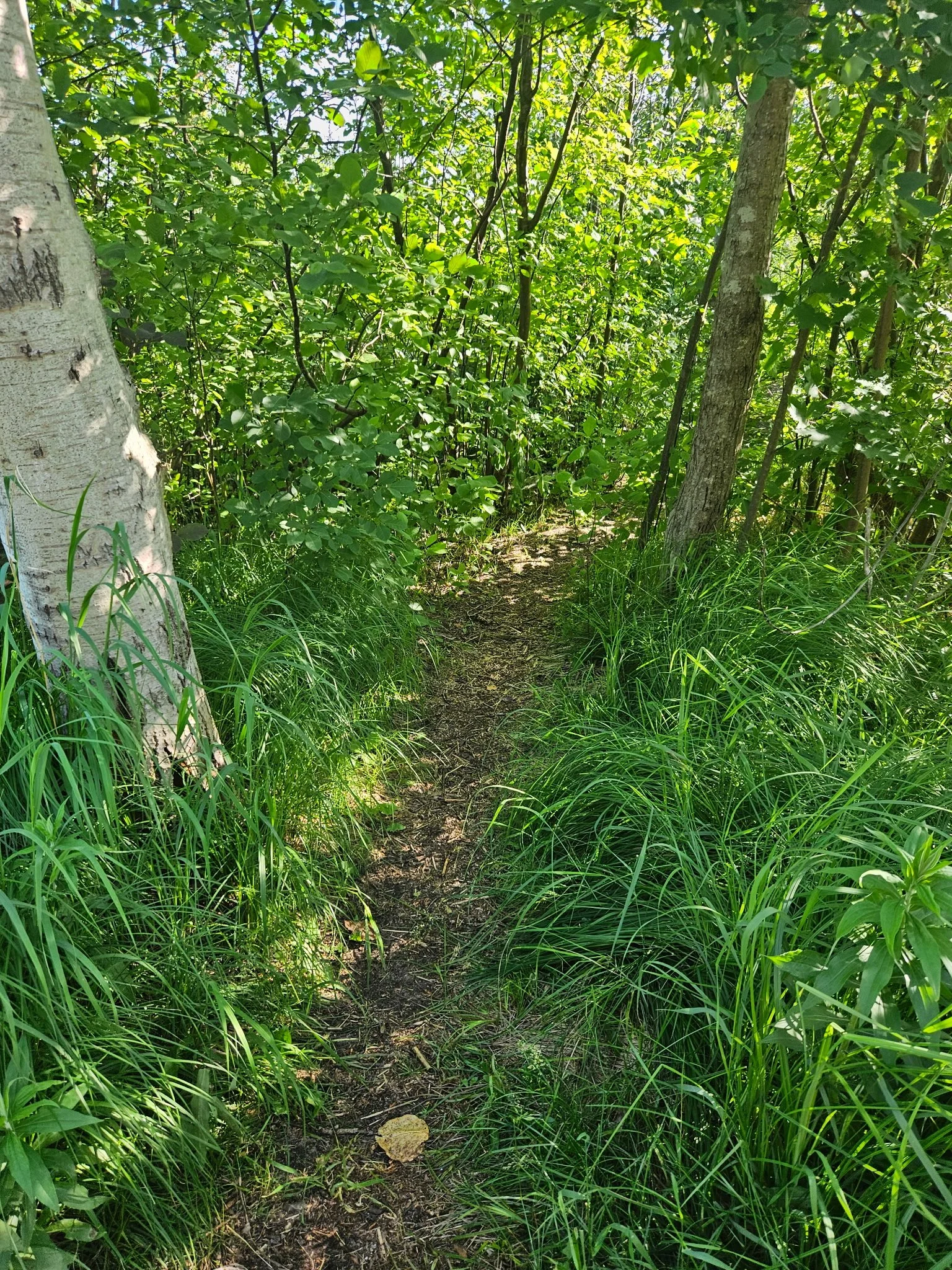
Secret Bayou Path. Photo by Tony Barnes
-
Very flat terrain with well-maintained boardwalks and soft pine-needle paths. This is a low-impact outing. It is designed for total accessibility, ensuring you can enjoy the natural beauty of the Bayou without worrying about steep climbs or technical footwork.
-
Best to move at a slow, observant speed. The goal here is to blend into the environment, giving us the best opportunity to spot turtles, migratory birds, and other local residents that call the Bayou home.
-
The route primarily utilizes well-maintained crushed gravel path of the Iron Ore Heritage Trail and sturdy wooden boardwalks that keep you high and dry above the wetlands. It’s a clean, stable way to experience the heart of the marshland.
-
Take in the unique beauty of the slow-moving "sloughs," keep your eyes peeled for active birdlife, and enjoy the calming presence of the water as it winds its way toward Lake Superior.
-
The Bayou is in Harvey so it is best paired with an area like downtown Marquette that is nearby and brings you back to the city for further exploration. You also start and end across the highway from the Marquette visitor’s center so a walk around Kona Hills is also a perfect way to balance the bayou.
A serene escape into one of Marquette’s most vibrant ecosystems the Chocolay River Bayou offers a peaceful immersion into a lush, winding waterway ecosystem. This area is a haven for local wildlife, where the slow-moving river meets wetlands, towering marsh grasses, and quiet forest edges. It is the ideal destination for those seeking a tranquil, "off-the-beaten-path" experience where the soundtrack is provided by the water and the wind through the trees.
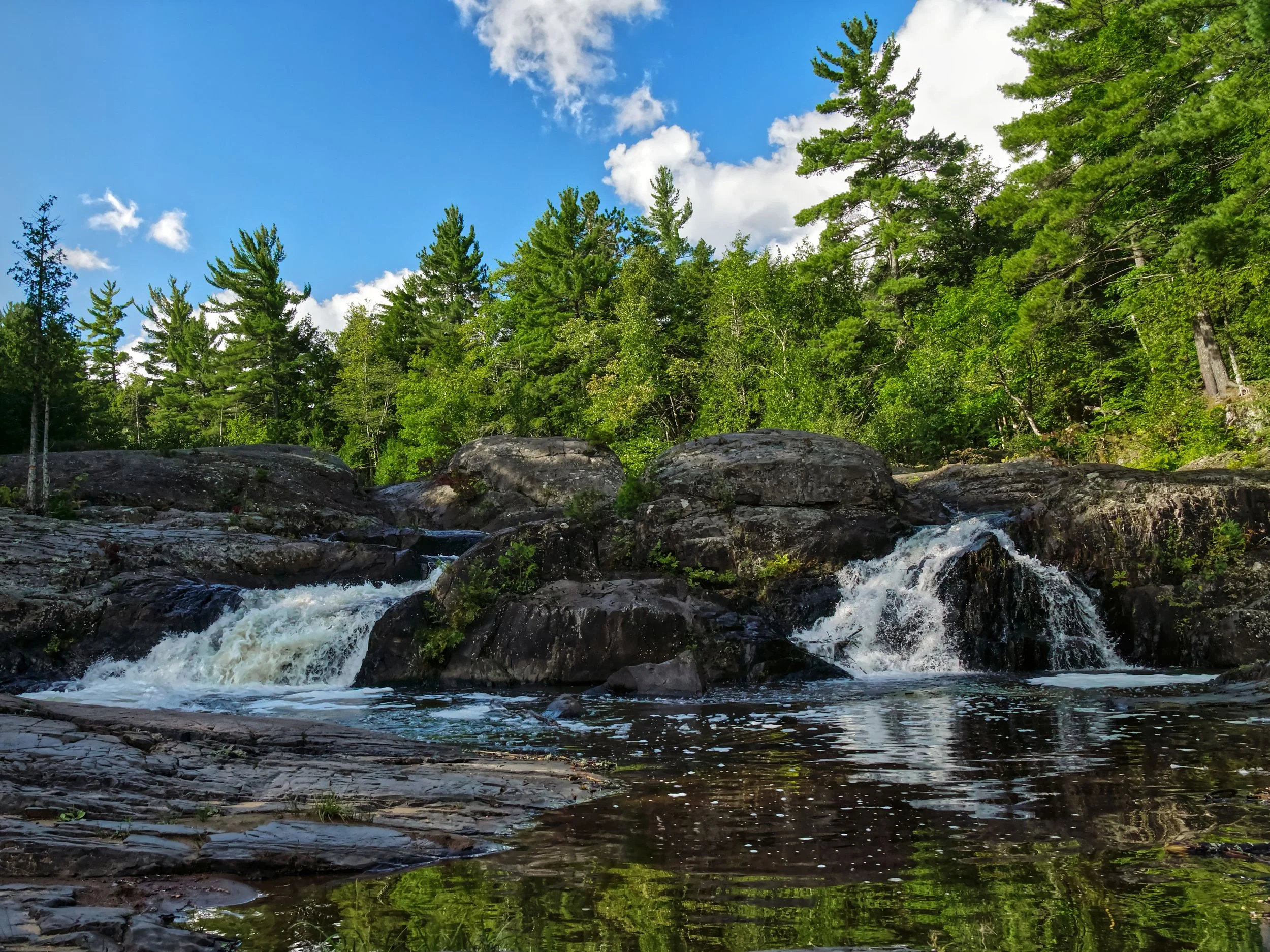
Lower Dead River Falls
Lower Dead River Falls. Photo by Tony Pelletier.
A beautiful, accessible introduction to Marquette’s waterfall country. This location showcases the raw power of the river as it drops toward the lake in a series of cascades, carving out a dramatic landscape of rushing water and quiet backwaters. It’s the perfect way to experience the rugged beauty of a river canyon without the strenuous vertical climbing required further upstream.
-
Prepare for a more authentic hiking experience. The trail features uneven terrain, including roots and rocks, along with some elevation changes that require steady footing and a bit of effort.
-
We maintain a consistent rhythm to navigate the varied terrain. While we certainly stop for the views, we keep a purposeful pace that allows us to explore the different water features efficiently.
-
This is a true forest-trail experience. Unlike the paved city paths, these are natural dirt and rock tracks that put you right in the heart of the urban woods, requiring sturdy footwear and a bit of agility.
-
Experience the rush of the falls, see the massive historic penstock (a giant pipe used for hydroelectric power) and enjoy the mirror-like stillness of the nearby Oxbow Lake.
-
You can naturally combine a hike to the lower Dead River falls with the North Trails since the trail systems connect to one another.
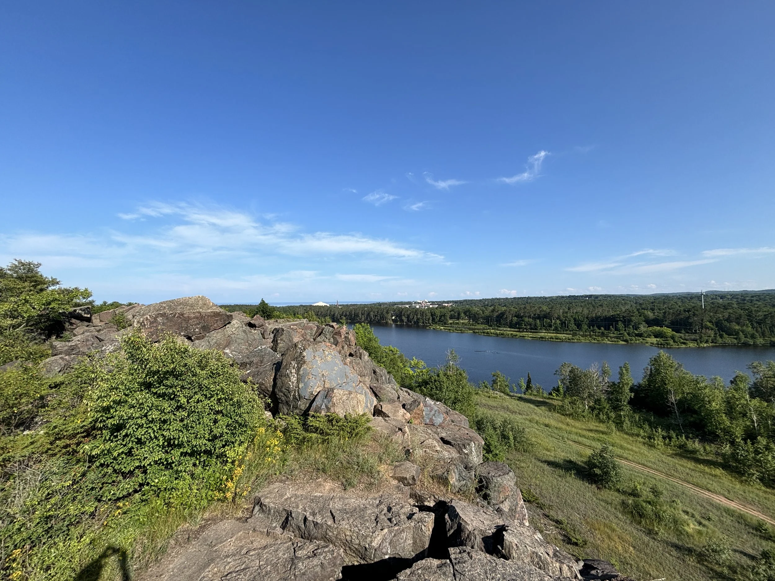
North Trails
Dead River and Superior Dome. Photo by Tony Barnes.
Explore the heart of Marquette’s premier forest network. This trip takes you deep into the North Trails, a sprawling system of ridges, pines, and river bluffs. We’ll navigate the winding North Country Trail to reach the high-point overlooks that provide a bird's-eye view of the Dead River basin and the rugged interior of the Noquemanon trail corridor.
-
Expect rolling terrain, some sandy ascents, and winding paths with frequent elevation shifts. Plan for roots, rocks, and ruts. While there aren't many sheer cliffs, the constant change in elevation and the natural forest floor require a good level of physical engagement.
-
A steady, athletic pace that covers significant ground while allowing for stops at the major vistas.
-
The paths here are "singletrack" style - narrow, natural-surface trails that wind through the trees and over exposed rocky outcrops. It’s an authentic, rugged experience that puts you in direct contact with the prehistoric geology of the region.
-
We’ll walk through majestic stands of red pines, catch glimpses of the Dead River snaking through the valley, and visit the serene, glass-like waters of Oxbow Lake.
-
Aside from connecting to the Lower Dead, the trailhead for the North Trails is at the start of 550 so it is a great way to warm up before heading north to the Little Presque Isle Multi-Use Pathway.
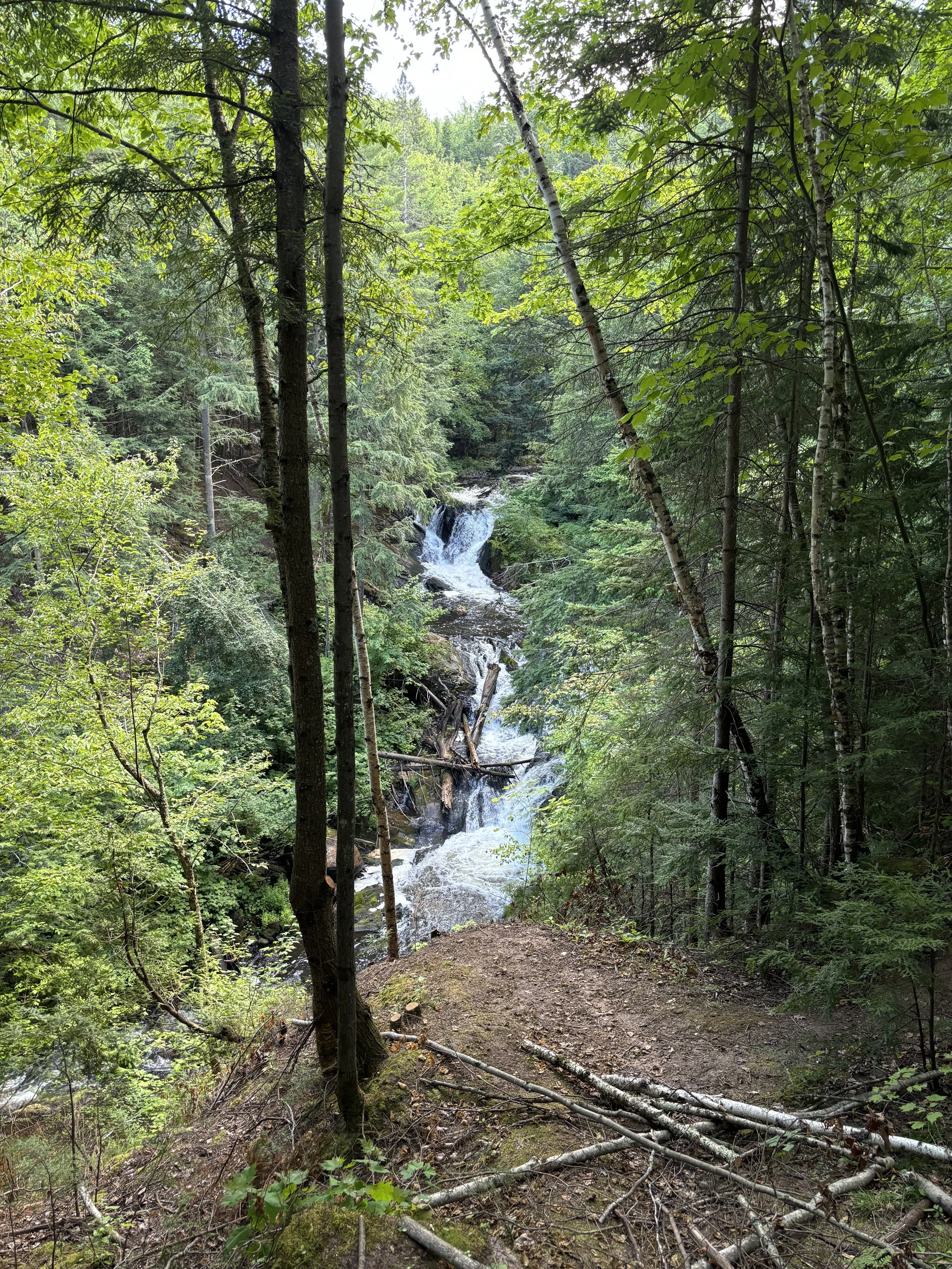
South Trails
Carp River Falls. Photo by Tony Barnes.
The South Trails offer a deeper sense of isolation and a more rugged, "wilderness" feel than many of the trails closer to the city. This area follows the valley of the Carp River, winding through dense, lush forests that stay vibrant and green throughout the summer. It’s a favorite for those who want to experience the elevation and varied topography that the Marquette area is famous for, all while feeling tucked away in the deep woods.
-
The South Trails are known for their rolling terrain and constant elevation shifts. We’ll be navigating natural forest floors that include roots, rocks, and some steady climbs that will definitely engage your legs.
-
We keep a high-energy, steady clip. This location is perfect for visitors who want to cover more miles and feel the physical reward of a true U.P. hike while moving efficiently through the forest.
-
The south trails are a bit of a maze with most people using them for mountain biking. Knowing where to hike and how to access the two rut shortcuts is key to enjoying this area.
-
Experience the hidden beauty of Morgan Falls as it spills over ancient rock, follow the scenic bends of the Carp River, and immerse yourself in some of the most lush, vibrant forest cover in the county.
-
If you’re looking to build an itinerary that includes overlooks, pair this with a trip up Mt. Marquette or the Greywalls Ridge to see the dramatic rocky outcroppings that define our local geology alongside stunning views of Marquette.
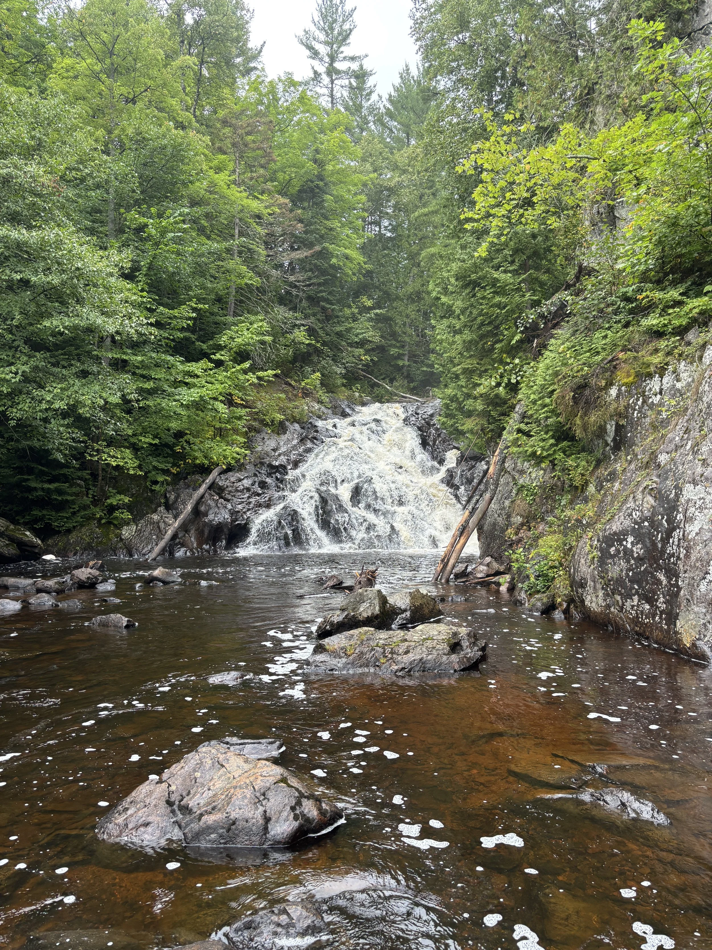
Yellow dog river
Pinnacle Falls on the Yellow Dog River. Photo by Tony Barnes.
This is the pinnacle of Upper Peninsula wilderness guiding. In the McCormick Tract, the Yellow Dog River is a federally designated Wild and Scenic River, and for good reason. It is raw, remote, and unforgiving. This isn't a walk on a trail. It is a true backcountry mission. We will leave civilization behind to bushwhack through old-growth forests, navigate riverbank chutes, and discover the hidden waterfalls of the Yellow Dog Plains. This trip is for the true adventurer looking for total solitude and a connection with the most pristine watershed in the Midwest.
-
Requires high physical fitness. Be prepared for off-trail bushwhacking, river crossings, and navigating through dense brush and fallen timber. It requires a good level of physical fitness and a sense of adventure.
-
This is a full-day commitment including the remote drive-in and an exhaustive exploration of the river corridor. We maintain a steady, purposeful energy to navigate the backcountry miles. While the terrain requires careful footwork, we keep moving to reach the most remote falls and overlooks, ensuring a full day of deep-woods touring.
-
The journey begins where the dirt road ends. We utilize remote forest trails that are often narrow and unimproved and off piste access, offering a true backcountry experience far removed from the manicured paths of the city.
-
Experience a series of stunning, powerful waterfalls hidden deep in the forest. The real highlight, however, is the profound silence and untouched beauty of a river system that feels exactly as it did hundreds of years ago. Other than at 510 and Pinnacle Falls, there is a high probability of not seeing another person all day.
-
After a rugged day on the Yellow Dog, the best way to round out the experience is a pop in Big Bay at the Lumberjack or the Thunder Bay Inn. We can head further north to this historic timber town for a post-hike drink or meal, giving you a taste of the remote community that serves as the gateway to the Huron Mountains.